
Delaware Valley Regional Planning Commission (DVRPC) has completed their Level of Traffic Stress Connectivity and Analysis for the PA Suburban Counties.
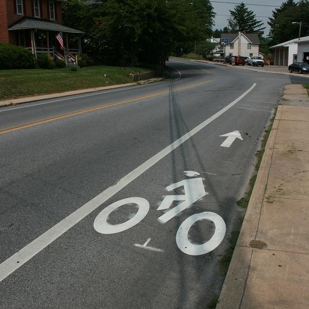
Level of Traffic Stress (LTS) is a bicycle comfort index methodology for streets and paths developed by Peter Furth at the Mineta Institute. Levels of traffic stress range from 1 to 4 with LTS 1 being quiet streets, protected bike lanes or trails being suitable for all ages to LTS 4 which include roads with higher speed traffic or close proximity to high speed traffic.
At the request of the Bike Lanes on Suburban Roads task force the DVRPC added a LTS analysis for the Pennsylvania Counties to the DVRPC Work Program. The first phase was an existing conditions analysis of all roads in the 5 County Region.
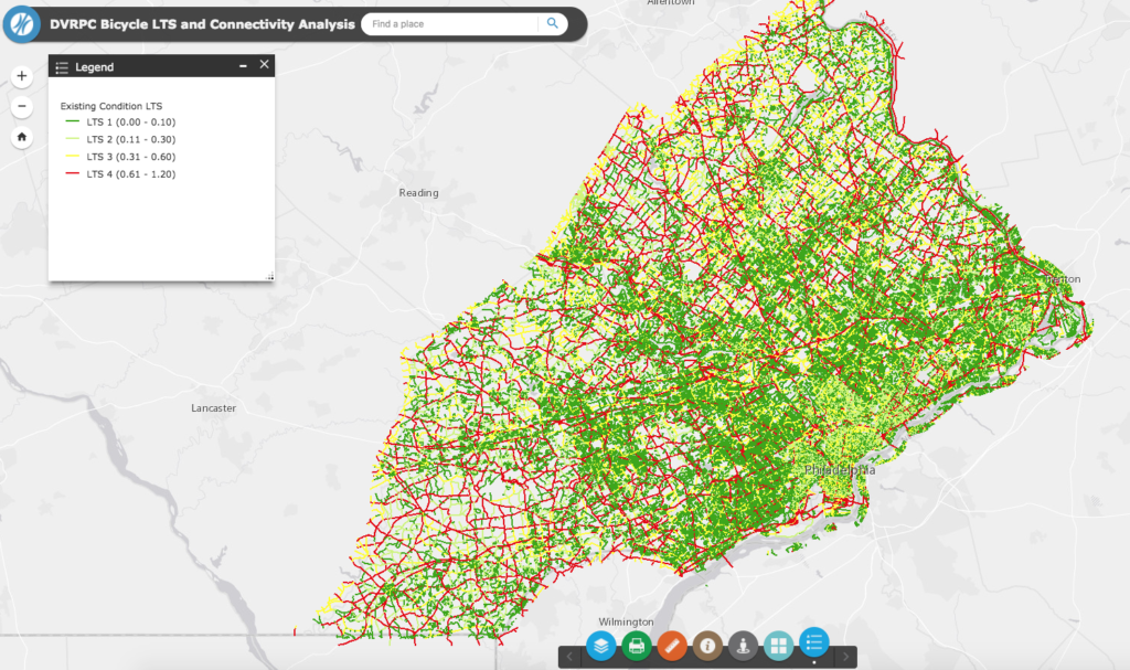
Level of Traffic Stress Existing Conditions
After that was completed the team headed by Planner Sarah Moran worked on a connectivity analysis. This analysis first sorted out the Low-Stress Islands which in the suburbs are often composed of neighborhood streets as well as Circuit Trails which are considered in most cases LTS 1 facilities.
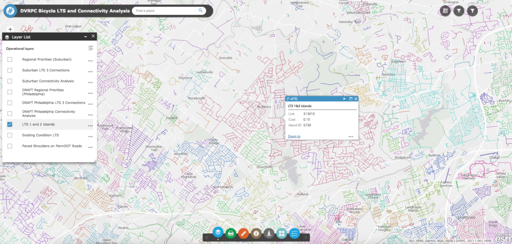
Then they did a GIS routing analysis of the shortest distance between every island using the moderately high-stress roads (LTS 3). The street segments that connected the most island to island paths (top 10%) then became DVRPC bicycle improvements priority segments to target investments in the suburban road network.

LTS 3 Connections (light blue) including the high regional priority connections (dark blue)
This map is wonky and wonderful. It will transform the way the region plans for bicycle mobility and safety. DVRPC will continue to refine this map to include more destinations make changes based. Eventually the map will be expanded to the New Jersey counties as well.
A big thank you goes out to Sarah Moran along with the GIS department at DVRPC. The Bicycle Coalition plans to use the map data for our technical assistance program for suburban bicycle routes which will be rolled out in 2018. The interactive map along with a user guide is available online, here.
The major flaw of the recommendations analysis, among other things, is that it biases making improvements to areas with a lot of LTS 1 routes or that are simply LTS 1 by their street pattern, which is silly when not taking actual usage statistics into account. Also, it seems like a needless political deference to deliberately avoid improving LTS 4 connections along arterials, when these are the most crucial to improving regional bike connectivity outside of the limited Circuit trails.