The Forge to Refuge Trail is an ambitious, multi-municipal trail proposed to connect Valley Forge National Park in King of Prussia with the John Heinz National Wildlife Refuge in Southwest Philadelphia, near the Philadelphia International Airport. The proposed Forge to Refuge Trail runs through five municipalities and will be approximately 30 miles long when complete. For implementation, the Forge to Refuge Trail is divided into smaller, more manageable segments, implemented within each municipality.
Stub Ends
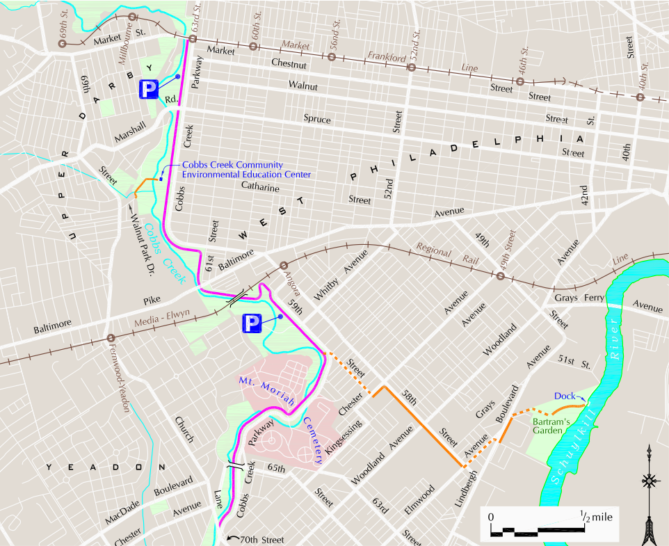
Currently, the built sections of the Forge to Refuge Trail consist of two stub ends: one in Philadelphia and one in Radnor Township. On the southern end, the built portion of the Forge to Refuge Trail in Philadelphia is called the Cobbs Creek Trail, which runs from 70th Street following the Cobbs Creek north to 63rd and Market Streets.
This segment also links to the 58th Street Connector, which provides access to Bartram’s Gardens to the east. Philadelphia is working to fill the approximately three-mile gap from 70th Street south into the Heinz Refuge.
The north end of the Forge to Refuge Trail will eventually connect with the trail system within Valley Forge National Park. Currently, the northernmost completed trail section of the Forge to Refuge Trail is the Radnor Trail, built on a former rail bed between Sugartown Road and S. Radnor Chester Road.

Progress
We are excited to announce that, on May 23rd, the Radnor Township Board of Commissioners signed two resolutions that will move the Forge to Refuge Trail forward. The first resolution adopts the Forge to Refuge Feasibility study available here. The Feasibility Study covers 6 miles of the nearly 10-mile gap between the stub ends in Radnor and Philadelphia.
The second resolution authorizes the study and design of two new segments of the trail discussed in the Feasibility Study. One segment will extend the Radnor Trail approximately 1.5 miles between the current stub end at S. Radnor Chester Road to Sproul Road on Villanova University campus. This segment will utilize, in part, the old rail bed pictured below.

The second segment under study is a 4.5-mile westward extension of the Cobbs Creek Trail from the current stub end at 63rd and Market Streets to E. Eagle/W. Wynnewood Road in Havertown, utilizing City of Philadelphia and Haverford Township parkland along the Cobbs Creek (sometimes called by its Native American name Karakung Creek).
For maps and details of proposed routes see the full Feasibility Study.
Kudos to the Radnor Township Commissioners for passing these exciting resolutions and for sponsoring the Forge to Refuge Feasibility Study for the five municipalities along the Forge to Refuge Trail.